
Bristol ZIP Coverage
USPS groups 37620 and 37621 under BRISTOL TN 37620. Those are the verified Bristol, Tennessee destination ZIPs in the USPS material reviewed for this directory. City Hall and Planning use 37620. The Sullivan County Clerk identifies its Bristol office at 801 Anderson Street with 37621. That does not make either ZIP a city-boundary line. It only establishes a postal relationship that should be checked against the specific street address.
| ZIP | Areas Covered | Post Office | Notes |
|---|---|---|---|
| 37620 | Bristol, TN destination ZIP; central and downtown city addresses include City Hall and Planning | USPS groups it with 37621 under BRISTOL TN 37620 | A delivery ZIP is not proof that an address lies within Bristol city limits. |
| 37621 | Bristol, TN destination ZIP; the County Clerk lists 801 Anderson Street in this ZIP | Confirm the individual address with USPS | Nearby official pages can format office ZIPs differently, so use address-level verification. |
| 37617 and 37618 | Census ZCTA overlap with Bristol city geography | Use USPS City/State or address lookup before assigning a postal city | ZCTA overlap is statistical geography, not a USPS Bristol-delivery claim. |
Do not add 37625 to a Bristol postal listing as a city-serving ZIP on the strength of nonofficial lists. The research did not verify that claim through an official USPS result. A ZIP can help sort a stack of addresses, but it cannot verify a person, company, owner, or household at one of them.
Verify Bristol ZIP Delivery
The USPS lookup is the authority for checking a delivery ZIP. Its City and State mode is a useful first pass for Bristol, Tennessee. For an actual address, use the address mode, because the street address is required and the result can provide the relevant ZIP or ZIP+4. USPS also warns that a returned result does not confirm that a named person or company occupies the address.
Keep the result with the full address used to obtain it. A postal city name can be broader than a municipal jurisdiction, and an address written in a historic source may need present-day spelling or a confirmed street location before it can be checked. If an older directory says only Bristol, establish the Tennessee or Virginia side before connecting it to Sullivan County property records. The postal tool answers a delivery question. It does not establish parcel ownership, legal jurisdiction, voter status, a household, or an agency’s record custody.
The captured USPS Bristol delivery-area reference shows the 37620 and 37621 grouping. It supports the postal scheme, not a claim about municipal limits or current occupants.
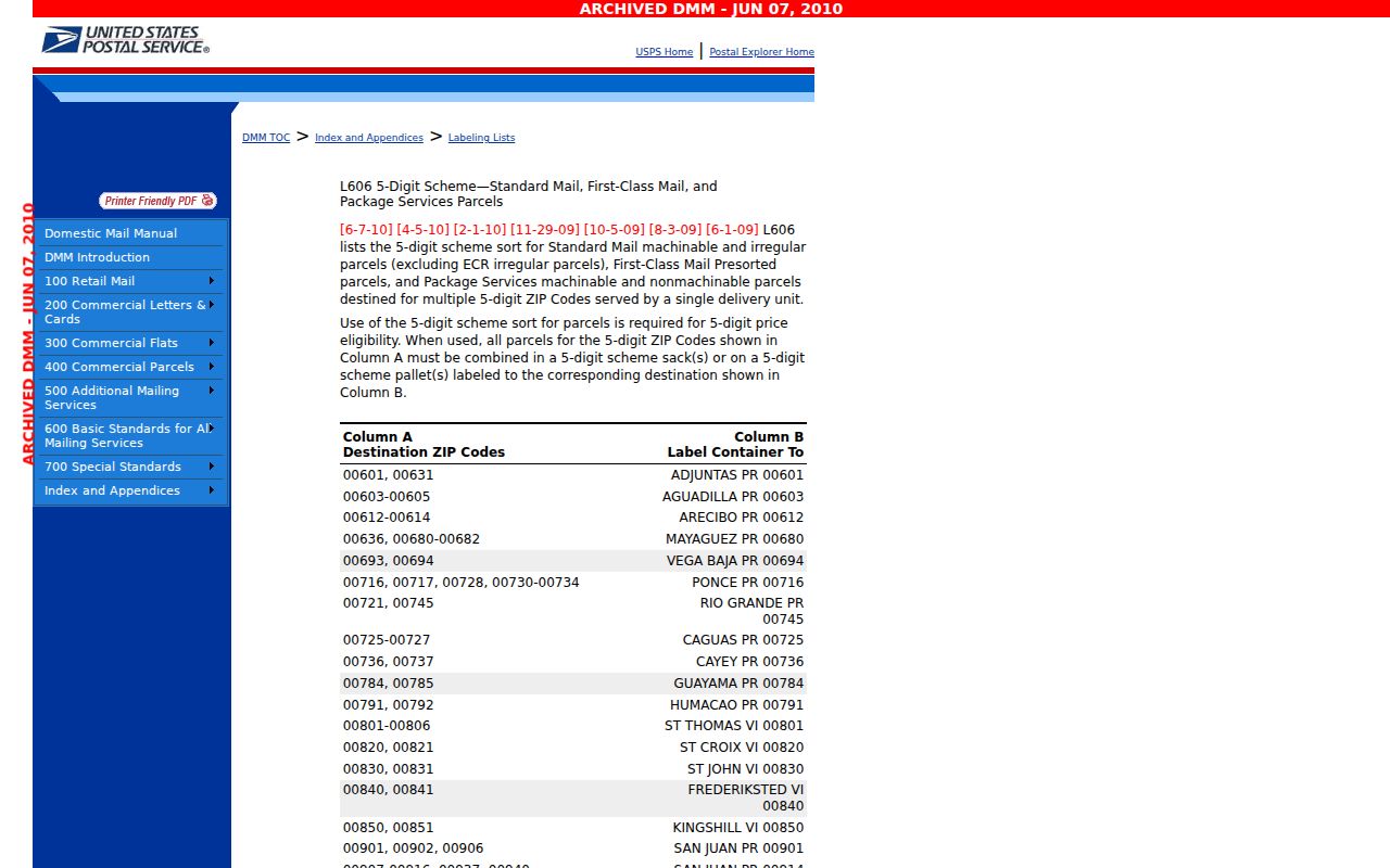
Use that scheme as a starting point, then let the address-specific USPS result settle the mailing label before consulting a local record.
Bristol ZIP Search Limits
A ZIP narrows a mailing question, not a countywide people list. The Tennessee Property Assessment Data system, or TPAD, has owner, property address, subdivision, classification, sale-date, map, and parcel inputs for Sullivan County. Its inspected Advanced Search did not expose a ZIP field. The owner result concerns property ownership, not a statement that the owner presently lives there.
The Tennessee Voter Registration Lookup and Absentee Ballot Status Tracker likewise has no ZIP control. It matches one registration with Sullivan County, first name, last name, birth month, and birth year. The Sullivan County interactive zoning map has verified address search and a zoning layer, but no verified ZIP filter. None of these sources should be described as a ZIP-wide resident roster.
- Enter the full street address in the USPS address tool and record the returned ZIP or ZIP+4.
- Check that the address is on the Tennessee side of State Street before using a Sullivan County source.
- Use the address in TPAD or the GIS viewer to find the parcel, zoning context, or owner record.
- Use the voter tracker only to authenticate a specific voter with its required matching details, not to browse a ZIP.
- When a street-level record is needed, continue with the Bristol street directory workflow.
This sequence keeps the Bristol postal reference focused on delivery verification while sending parcel and street research to systems that are actually keyed to an address.
Bristol ZIP Lookup Inputs
USPS provides three separate lookup modes. Their required inputs explain why a ZIP result is strongest when the street address is known. The modes do not search for residents. They standardize and verify postal geography.
| USPS mode | Required input | Useful Bristol result |
|---|---|---|
| Address lookup | Street Address; City; State | Address-level ZIP or ZIP+4 confirmation. Company and Apt/Suite are optional. |
| City and state lookup | City; State | Review postal-city results for Bristol, TN before testing an address. |
| Cities by ZIP | ZIP | See the cities USPS associates with a ZIP, without inferring occupancy. |
Keep the returned spelling with the source notes. USPS may standardize an address differently from the wording first entered, and that difference can matter when matching it to a local parcel record.
Bristol Parcels and ZIPs
TPAD is valuable after USPS verifies an address, but it does not convert postal information into a ZIP search. A TPAD result can show the property address, owner, Control Map, Group, Parcel, subdivision, lot, class, special-interest indicator, and sale date when displayed. Those fields tie a record to land or assessment context. They do not identify non-owner occupants, household members, utility customers, or a guaranteed current owner mailing address.
Within TPAD, select Sullivan County and start with an address, an owner name, or the parcel clues already in hand. A street number may be optional in an address query, and an Advanced Search can narrow a common surname with property, subdivision, sale-date, or map-and-parcel information. Save the live tax year or data date shown with any result. The Assessor maintains assessment maps and tax rolls, but it does not set tax rates, mail bills, or collect taxes, so those questions belong to the county office responsible for them.
| Field or description | What it identifies | Boundary to keep |
|---|---|---|
| Control Map, Group, Parcel | TPAD parcel components, with the parcel format using a five-digit parcel and an optional decimal after the third digit | Parcel identifiers are not postal ZIP fields. |
| Situs address | The land or building location used by street and GIS systems | It may differ from where tax mail is sent. |
| Mailing address | Tax correspondence address, if a particular public record displays it | It is a clue, not proof of a physical presence. |
| Legal description | Recordable land description, such as subdivision and lot | It connects deeds and plats even when street labels change. |
For a parcel close to a postal or city edge, compare the situs address, map components, legal description, and the address-specific USPS result. That is more reliable than trying to infer a ZIP from a deed party or an owner field.
Bristol ZIPs at State Street
Bristol is a Twin City, not a single-jurisdiction postal shortcut. The City of Bristol history records an 1852 survey across Tennessee and Virginia land. State Street later became the state boundary: the centerline was designated in 1881, and a 1903 Tennessee cession placed the line in the middle of the street. An address labeled simply Bristol can therefore belong to a different state and county system.
For an address on the Virginia side, stop before querying Tennessee property, court, voter, or public-records sources. Re-route it to Virginia records. A Bristol postal reference can help verify mailing wording, but it cannot decide the legal side of the boundary.
The City history reference gives the local boundary context behind this ZIP caution.
Postal, city, county, and state labels should remain separate in notes about any Bristol address near State Street.
Bristol City Limits and ZIPs
City limits change through municipal action, while ZIPs serve postal delivery. Bristol Planning handles annexations, rezoning, site plans, special uses, and variances. A 2025 Highway 394 annexation report tied a proposal to Sullivan County tax map 068 130.50 and Resolution 25-60. It is a practical reminder that a city-limit question cannot be answered from a ZIP alone.
When the question is city service, zoning, or annexation rather than mail delivery, the City and the county parcel record are the appropriate sources. Preserve the date of a live TPAD result, too: the county’s 2025 reappraisal review shows why assessment information should not be treated as static.
Planning jurisdiction, the tax map, and postal delivery can each describe a different part of the same research problem. Record which source supplied each conclusion. That simple separation helps when an address has a Bristol mailing label but a question concerns a city action, a county parcel, or an office that serves only one side of the state line.
Bristol ZIP Terms
Postal terms describe delivery, not ownership, residence, or jurisdiction. Keeping them straight makes the Bristol ZIP code directory more useful when an address appears in a letter, a parcel record, or a historic directory. A precise USPS answer can include more detail than the five-digit ZIP, but it still needs to be paired with the address and record type being researched.
- ZIP and ZIP+4
- A ZIP is the basic postal routing code. ZIP+4 adds a more specific delivery segment for an address, unit range, or other delivery point.
- PO Box ZIP
- A postal ZIP associated with post-office-box delivery. It should not be assumed to locate a person’s physical address.
- Unique ZIP
- A ZIP assigned for a single high-volume recipient or organization. None should be assumed for Bristol without a USPS result.
- Carrier route
- A delivery sequence used by the Postal Service. It is not a municipal district, a parcel boundary, or a roster of residents.
For historic Bristol material, the local library’s directories and maps may show an address that needs jurisdiction checking before it is paired with current postal or county data. The address side of State Street remains the first test.