
Bristol Previous Residents by Era
A backward address history needs a source for each era. The current assessment record connects a modern address to a parcel and legal-description clues. The Register of Deeds supplies recorded instruments, while Bristol Public Library's selected city directories capture name and address snapshots. Census, Sanborn maps, municipal files, and archival material answer narrower questions. No one source proves every past household, so a good Bristol previous residents trail keeps ownership, occupancy, and building context in separate columns.
| Source | Years it covers | Where held | What it contributes |
|---|---|---|---|
| Register and TSLA deed material | Examples verified from 1809-37; current web cutoff not verified | Register counter and TSLA microfilm | Legal-title history and party names |
| BPL city directories | Selected 1896-1949 runs | BPL digital archive | Printed name and address snapshots, plus street guides |
| Sanborn maps | 1907 and 1913 | Library of Congress online | Building, street, and neighborhood context |
| Federal census | Through the 1950 public release | National Archives and library resources | Household composition and enumeration context |
| Permit or code file | No public chronological index verified | City Development Services and TPRA request | Address-specific project evidence if a responsive record exists |
Start with the period that is known. A family historian working before the earliest directory scans should expect more work at the Register counter and Tennessee State Library and Archives. A recent address question begins with the live parcel record, but that result is not historical occupancy evidence.
Bristol Address History Starts With TPAD
Tennessee Property Assessment Data is the practical first stop for a Bristol, Tennessee property lead. Select Sullivan County, then search by property address, owner name, or parcel ID. The advanced fields include owner, property address, subdivision, classification, sale-date range, and map-parcel components. The results grid identifies owner, property address, control map, group, parcel, parcel ID, subdivision, lot, class, special interest, and sale date when supplied.
TPAD identifies an assessment relationship. It does not list non-owner occupants, household members, utility customers, or a guaranteed current owner mailing address in the inspected result grid. Preserve the property address and parcel components, then use the legal description to locate the acquisition deed. A modern street number is useful for finding the parcel, but it is not the permanent deed-search key.
- Situs address
- The street location of the land or building used by address and map systems.
- Parcel ID
- The assessment identifier formed from local map, group, and parcel components.
- Legal description
- The recorded description of land, such as lot, block, subdivision, or metes and bounds, that connects deeds more reliably than a changing street address.
Bristol Address History Through Deeds
The deed chain is a chain of title, not a roster of occupants. Start with the current owner and legal description from TPAD, then ask the Sullivan County Register of Deeds for the acquisition instrument. Tennessee's statutory indexing system uses a direct index for grantors and a reverse index for grantees. The purchaser is the grantee on the acquisition deed. The seller is the grantor. That flip is the key to moving backward through past owners.
- Record the current parcel, legal description, subdivision or lot, and owner lead from TPAD.
- Locate the current owner's acquisition deed through the Register by party, date, book and page, document number, or legal-description clue.
- Copy the purchaser as grantee, seller as grantor, instrument type, execution or received date, and book and page.
- Search that seller as a prior grantee to find the seller's earlier purchase, then repeat the same recording steps.
- Stop and recheck the legal description when a lot split, tract change, or record gap breaks the name sequence.
- Grantor
- The party transferring an interest in the recorded instrument, commonly the seller in a deed.
- Grantee
- The party receiving an interest in the instrument, commonly the purchaser in a deed.
- Chain of title
- The sequence of recorded transfers that connects one owner or tract interest to an earlier one.
Note: A deed party documents a recorded land transaction, while a historical directory householder documents a dated printed listing. Neither one alone proves present occupancy.
Bristol Address History Beyond the Web Index
The Register confirms an online-record route, but its unauthenticated destination did not reveal a reliable start year, full image access, or current fees. Do not assign an online cutoff that the office has not published. Use the online path for a current lead, then move to the Register counter at 3411 Hwy 126 in Blountville when the web trail stops. The office is open weekdays from 8:00 a.m. to 4:30 p.m. and lists 423-323-6420 for contact.
Tennessee genealogy-index search is a state archival entry point for a family-history question.
The TSLA county-record microfilm inventory supports that archival fallback. Its surveyed examples include Sullivan deed volumes 6 from 1809-15, 7 from 1815-19, 9 from 1819-34, 10 from 1824-30, and 11 from 1830-37. Those are verified early volume examples, not a claim that all title records are online or that every building was already present. Bring known parties, a book and page when possible, and the legal description to the counter or archive inquiry.
Bristol Address History in Directories
Once the title trail identifies an address period, turn to the household and street guides in the selected Bristol directory runs. Bristol Public Library begins its digitized run at 1896-97 and continues through selected 1948-49 volumes. Locate the historical street, number, and nearest intersections in the householder guide. Then check the alphabetical listing for occupation, spouse notation, telephone information where the edition includes it, and the difference between a person and a business listing.
The collections themselves are described in more detail on the Bristol city directory page. Here, the directory is one piece of an address trail. It can show a householder or concern opposite a printed address, but it cannot prove continuous residence, ownership, or an exact move date. A gap in BPL's nonannual scans is a collection gap, not evidence of a move.
Sullivan Chancery Court is a local probate follow-up channel for a household trail that reaches an estate.
At the end of a household trail, a probate file can identify an estate or named heir relationship. Sullivan Chancery and Clerk and Master records have a Bristol office at 801 Anderson Street, while probate administration also has a Blountville counter. Restricted personal information may still be withheld or redacted.
Bristol Address Census and Map Pairing
Federal census records complement, rather than replace, the Bristol street guides. Public federal releases now reach 1950. Pair a directory edition with the closest census available for the same neighborhood, and compare the address, household names, and period. Do not expect the census to supply the same street address format. Enumeration geography and historic street intersections can help bridge the difference.
- Write the address and intersections exactly as printed in the directory.
- Locate the nearest public census year and compare the household names and the broader location.
- Use the 1907 and 1913 Sanborn sheets to see building footprint, use, and street context.
- Return to the deed's legal description when maps or printed numbering create uncertainty.
Sanborn maps support building context only. The 1907 set has 35 sheets and the 1913 set has 41 sheets. They do not name residents, establish ownership, or turn an unlisted household into a documented resident. A mismatch between a map and a later street number is a reason to recheck intersections and the legal description, not a reason to assume the address represents a different property.
Bristol Address Records Across State Street
Bristol's first survey in 1852 covered 48 Tennessee acres and 52 Virginia acres. State Street's centerline became the boundary in 1881, and a 1903 Tennessee cession put the line in the street's middle. That history makes the state side an essential first check for anyone researching who lived here before. An old directory or newspaper may call both sides Bristol, yet Tennessee address records belong in Sullivan County and Virginia addresses need Virginia custodians.
The Birthplace of Country Music Museum is an archival local-history resource in historic downtown Bristol.
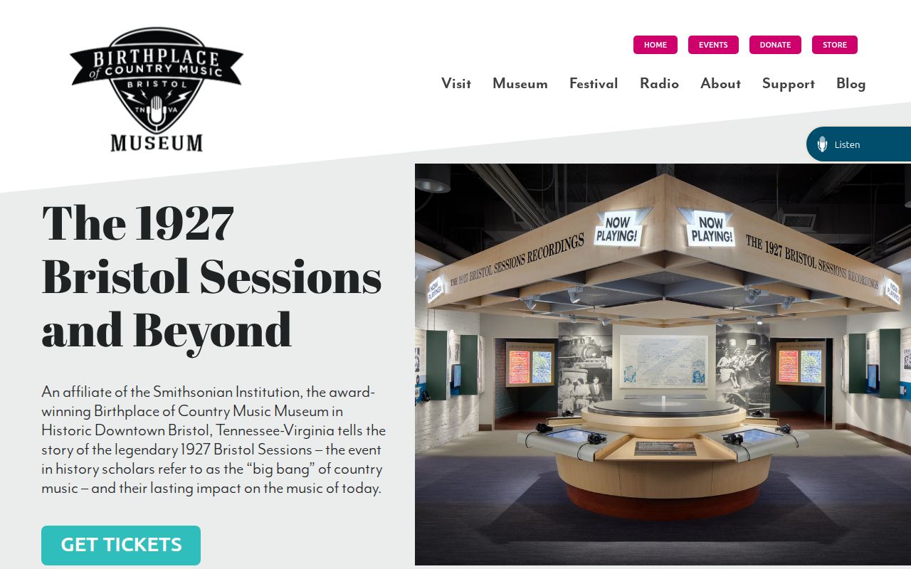
The museum's objects, photographs, ephemera, and digital archive can offer period context for families connected to the 1927 Bristol Sessions and regional businesses. It is not a land-title registry or a directory of previous residents. Use it to form a focused archive question after the address and time period are known.
Limits of Bristol Address-History Evidence
Previous residents research is strongest when used for house history, family history, estate questions, and personal curiosity. Keep a record of which source supports each conclusion. An assessment owner, deed party, directory householder, census member, and permit applicant can all be different people connected to the same address at different times. Missing information can reflect a collection gap, a redaction, a changed address, or a record held by another jurisdiction.
Lawful use. Use Bristol address history for a legitimate personal or historical purpose. Do not use old or current record details to stalk, harass, or harm any person.
For a city permit, code, demolition, or occupancy question, make a narrow Tennessee Public Records Act request to the City with a property address and date range. The city can evaluate an identifiable record request. It is not required to build a new narrative from a broad request for every record about a person.